Trip Introduction
The great and unprecedented crossing of Upper Dolpo
The Dolpo Trek has been one of the most popular destinations since it opened to foreigners in 1989. It is often referred to as the Himalayan Pilgrimage of Nepal
The Dolpo region is located in the northwest of Nepal (behind the Dhaulagiri massif) and is one of the most remote and least exposed places in Nepal. Legend has it that Dolpo is one of the hidden valleys created by Guru Rinpoche, a refuge for devout Buddhists in troubled times. The natives are originally from Tibet and have a primitive lifestyle and their own dialect. Isolated by a difficult topography, they were able to preserve their culture which has remained virtually unaltered by modern society and is one of the best examples in the world of the preservation of Tibetan Buddhism.
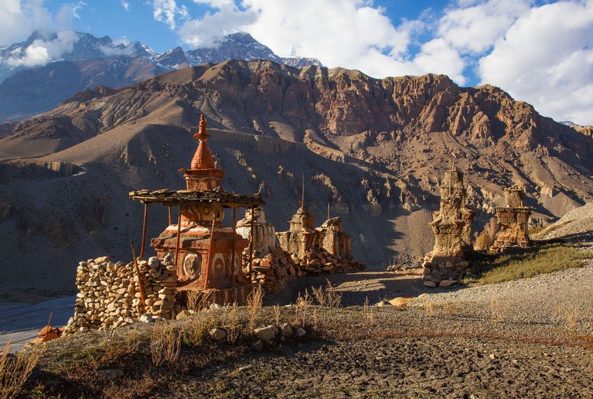
The Dolpo has been a living bookstore for many scholars who love to explore the origins of civilizations and Tibetan Buddhism. Several exceptional monasteries are to be seen such as Shey Gompa (crystal monastery) which is an important pilgrimage site for Tibetans.
The splendid landscapes are sometimes brought to life by caravans of yaks that make long distances over difficult terrain to barter. Among all the attractions of Dolpo, Shey Phoksundo Lake and its crystal clear waters, surrounded by rocks, forests and snow-capped peaks, is one of the hidden wonders of nature. It is located in the largest national park in Nepal: Shey Phoksundo National Park. The wonderful landscapes and the exceptional hospitality of the locals not only enchanted many trekkers but were also an exceptional experience for many of them.
An adventure that takes us from the little-known region of Lake Rara and the Mugu valley to Dolpo, then the gates of Mustang. After having crossed “the hidden country”, its monasteries and villages out of time, we continue towards Jomsom by the high passes which make it possible to join the tour of Annapurnas by more than five passes at more than 5000 meters.
Difficult level
This program is intended for participants in good physical shape, having a significant practice of sport, endurance in particular, having an excellent mental capacity allowing facing difficulties by nature unforeseen.
There’s no big carry, just a backpack for the day’s stuff. It’s a tough hike with 25 days of walking and stages of 6 to 8 hours of walking on average per day. Six passes including 5 over 5,000 meters.
Accommodation
In a standard category hotel (base: double room) in Kathmandu and Pokhara, during the rest of the trip in a tent (3-person tents for 2 people) or in a lodge depending on the trip. Lodges in Nepal are of very uncertain comfort. In general, conditions are quite good on the Annapurna turn and the Everest region. On the other hand, in Mustang, in the valley of Tsum and in the region of Kangch or Makalu, they can be very rudimentary to the point of being a dormitory sometimes even a kitchen. Lodges can look like a refuge or sometimes a lodge from our place. Most of the time it is a family house with double, triple or dormitory rooms. Toilets and showers are always separate. It is important to check that the water is not heated with wood, as this contributes to deforestation. Most of the time, the water is heated with solar energy.
Meal
In the cities, many restaurants allow us to discover the typical local cuisine. Meat is scarce, Nepalese are generally vegetarians. The basic ingredients are: rice, pasta, lentils, potatoes, vegetables. Snacks are included during the trek (cereal bars, dried fruits, etc.).
For tent accommodation: during the trek, breakfasts and evening meals are prepared by the kitchen team. They are taken under the mess tent. Depending on the profile of the stages (length of the day’s walk and / or presence of water), midday snacks will be served hot or cold in the form of picnics.
For lodge accommodation: meals are prepared by the lodge’s cooks and are taken in the lodge’s dining room. Here is a typical one-day menu:
- breakfast: eggs, toast or chapatti, or Tibetan bread or pancakes, or pancakes, butter / jam, tea or coffee
- lunch: a main course, tea or coffee
- dinner: soup, main course, fruit (fresh or canned), tea or coffee
During the trek, tea or coffee is served with meals. Two cups per person are included.
Apart from these included menus, other drinks and foodstuffs will be at your expense.
Water: provide tablets (Hydroclovazone, Micropur or other type) to disinfect the water you put in your flask, depending on the source and on the advice of your guide. Sometimes you can buy purified water and fill your gourd without having to buy bottled water. You can also buy mineral water in the cities (not included in the price) but it has poor ecological results, as you know. Also, we do not recommend it.
Itinerary
-
DAYS 1 & 2
SWISS - KATHMANDU
Flight from Europe to Kathmandu. Usually the arrival is during the day of Day 2. Welcome by our local team and free time to explore the city.
- Mode of transfer / transport: by private vehicle
- Duration of transfer / transport: about 1 hour
- Final altitude: about 1,300 m
- Meals: free breakfasts (not included) – free lunches (not included) – free dinners (not included)
- Accommodation: nights at the hotel
-
DAY 3
KATHMANDU - NEPALGUNJ
Fly to Nepalgunj around 1 hour, superb views of the Manaslu, Annapurna and Dhaulagiri massifs. Nepalgunj is located in the Terai plain, not far from the Indian border.
- Mode of transfer / transport: by private vehicle, by plane
- Duration of transfer / transport: about 3 hours
- Final altitude: about 280 m
- Meals: breakfast – lunch – dinner
- Accommodation: night in a lodge or in a single hotel
-
DAY 4
NEPALGUNJ - TALCHA - LAKE RARA
We take off for the small airport of Talcha near Lake Rara. We walk for three hours to the camp where the kitchen teams and porters are waiting for us. The trail runs along the lake with clear blue green waters. Walk in a beautiful forest of walnut, holm oak and coniferous trees along a sometimes marshy path.
NB: If the weather makes the flight impossible, we may be able to go to Talcha by helicopter under certain conditions: weather and sufficient number of participants to co-charter. For this we ask you to provide the sum of 200 euros in cash. We would take one third of the price and our Nepalese partner one third to split the cost into 3.
- Mode of transfer / transport: by private vehicle, by plane (40 min)
- Duration of transfer / transport: about 2 hours
- Number of hours of walking: about 3 hours
- Difference in height: + 600 m / – 635 m
- Final altitude: approximately 2,710 m
- Meals: breakfast – lunch – dinner
- Accommodation: night in a tent
-
DAY 5
LAKE RARA - LUMSA
We descend into the valley of Gamghadi, the capital of the district of the same name, and then we take a steep path that runs along the Mugu Karnali to Lumsa. Camp in the schoolyard.
- Number of hours of walking: about 6 hours
- Average daily difference in height: + 600 m / – 1,350 m
- Final altitude: around 1,900 m
- Meals: breakfast – lunch – dinner
- Accommodation: night in a tent
-
DAY 6
LUMSA - BHALE
We walk to the beautiful village of Chala, its carved wooden houses and its community flour mill. It is not uncommon to come across caravans of mules which come to supply the villages or herds of goats which feed along the path. We observe fields of millet, corn, amaranth and even cannabis plants. Stop at the village of Mangri then continue on to Bhale by following the gorges of the Mugu Karnali.
- Number of hours of walking: about 5 hours
- Difference in height: + 670 m / – 340 m
- Final altitude: about 2,230 m
- Meals: breakfast – lunch – dinner
- Accommodation: night in a tent
-
DAY 7
BHALE - TIYAR MONASTERY
We leave Bhale to follow the Mugu Karnali, after the confluence with the Namlang Nadi which comes straight from the Kanjirowa Himal and we enter the gorges. We may come across caravans of dzos and mules loaded with salt coming from Mugu. We will see the very beautiful abandoned monastery of Tiyar before setting up camp along the river.
- Number of hours of walking: about 5 hours
- Difference in height: + 310 m / – 225 m
- Final altitude: about 2,600 m
- Meals: breakfast – lunch – dinner
- Accommodation: night in a tent
-
DAY 8
TIYAR MONASTERY - SILENCHAURA KHARKA
We continue to go up the Mugu Nadi to reach Shilenchaura, the starting point for the caravans. Some tea shops are in operation according to the opening dates of the Tibetan border.
- Duration of transfer / transport: about 5 h
- Difference in height: + 950 m / – 370 m
- Final altitude: approximately 2,950 m
- Meals: breakfast – lunch – dinner
- Accommodation: night in a lodge or in a tent
-
DAY 9
SHILENCHAURA - THAJUCHAUR
You have to enter a gorge going up a torrent to discover the only possible camp for the end of the day. We are on the trail of the harvesters of Yarsa Gumbo, without them, there are no more paths…
- Number of hours of walking: about 6 hours
- Elevation: + 1,290 m / – 370 m
- Final altitude: approx. 4,050 m
- Meals: breakfast – lunch – dinner
- Accommodation: night in a tent
-
DAY 10
THAJUCHAUR - TAKLA KHOLA
The climb is easy on large grassy slopes. The pass (Chyargo La 5 150 m) is reached fairly quickly, weather permitting there are many peaks available to us. Laying down prayer flags before descending into a valley which gradually closes. We find a wild nature where humidity regains its rights.
- Number of hours of walking: about 7 hours
- Difference in height: + 1,150 m / – 1,230 m
- Final altitude: approx. 4,020 m
- Meals: breakfast – lunch – dinner
- Accommodation: night in a tent
-
DAY 11
TAKLA KHOLA - CHYANDI KHOLA
There are two paths to reach Bhijer from Silenchaura: the gorge path and the pass path. The condition of the paths can change quickly (bridge built or disappeared, landslide, etc.). We will indicate to those interested the route that we prefer based on current information. But as a rule, we take the one for the passes. After passing a camp on the banks of the torrent, very wet, we cross on a landscaped trunk before starting our first climb. Numerous views follow at each passage of the ridges, before descending to the next torrent. All that remains is to go up the stream to set up our camp as close as possible to the Yala La pass.
- Number of hours of walking: about 7 hours
- Difference in height: + 1,000 m / – 1,230 m
- Final altitude: approx. 4,020 m
- Meals: breakfast – lunch – dinner
- Accommodation: night in a tent
-
DAY 12
CHYANDI KHOLA - YALA LA (5 420 M) - PUNG KHARKA
This second neck is much more mineral. You have to go up a large circus before reaching the Yala La (5,420 m). The prayer flags are in number, we have just moved to Dolpo, finally…
All that remains is to join the torrent below, then follow it and pass Pung kharka, reaching the last possible camp.
- Number of hours of walking: about 7 hours
- Difference in height: + 850 m / – 760 m
- Final altitude: approximately 4,640 m
- Meals: breakfast – lunch – dinner
- Accommodation: night in a tent
-
DAY 13
PUNG KHARKA - PHO
Even if we are already in Dolpo, we still have the first “crux” of this route to cross: the Nyingma Gyanzen La pass. We must first continue down the stream a little before going up a small steep valley. . Then, reach a pass and a nearby summit. All that remains is to follow a beautiful ridge with exceptional views. In the distance, the village of Kuwagaon, the most northerly of the Dolpo … The descent is on the program to reach the village of Pho, a well-deserved stopover.
- Number of hours of walking: about 8 hours
- Difference in height: + 1,120 m / – 1,640 m
- Final altitude: approx. 4,090 m
- Meals: breakfast – lunch – dinner
- Accommodation: night in a tent
-
DAY 14
PHO
A day to breathe, finally.
For the more courageous, head for the gompa of this village, well hidden in a lost valley. Close, but which will again require some effort. Number of hours of walking: about 3 hours
- Difference in height: + 300 m / – 300 m
- Final altitude: approx. 4,090 m
- Meals: breakfast – lunch – dinner
- Accommodation: night in a tent
-
DAY 15
PHO - BHIJER
On the map, everything seems close. It is to forget the turbulent terrain of Dolpo. We have to reach a magnificent bridge in the valley before climbing steeply to the Yambur La pass. Depending on the season, a few currants can reward us. The descent is easy before being able to contemplate the village of Bhijer, a wonder in this season.
- Number of hours of walking: about 7 hours
- Difference in height: + 1,450 m / – 1,650 m
- Final altitude: approximately 3,850 m
- Meals: breakfast – lunch – dinner
- Accommodation: night in a tent
-
DAY 16
BHIJER - NANG LA BASE CAMP
This morning we stroll through the village, we visit the school then the monastery and we then climb up the hillside above the village to the Nang La base camp, in a beautiful, very lively kharka. We will not forget to taste cheese in the brand new cheese dairy in the valley.
- Number of hours of walking: about 3 hours
- Elevation: + 700 m
- Final altitude: approximately 4,350 m
- Meals: breakfast – lunch – dinner
- Accommodation: night in a tent
-
DAY 17
NANG LA BASE CAMP - NANG LA (5,400 M) - SALDANG
We pass the Nang La at 5,375 meters where we have a magnificent view of almost all of the upper Dolpo, we descend to Saldang, leaving aside the path that leads to Marang which, by itself, is another route…We descend from terrace to terrace to reach the surroundings of the Saldang gompa that we will visit to appreciate the work of the painter Norbu who has completely rehabilitated the murals.
- Number of hours of walking: about 7 hours
- Difference in height: + 800 m / – 1,450 m
- Final altitude: approximately 4,350 m
- Meals: breakfast – lunch – dinner
- Accommodation: night in a tent
-
DAY 18
SALDANG - KHOMAS
We have to cut the Naga Khola to start our ascent to the village of Khomas, one of the few in the Dolpo that is built on a flat … The ascent is gradual in a fairly mineral environment. We cross a small pass and the village comes to us. All the red gompas are on our right, all that’s left is to find the keys. Normally, they are in one of the last houses, below the village…
- Number of hours of walking: about 5 hours
- Difference in height: + 750 m / – 600 m
- Final altitude: approximately 3,620 m
- Meals: breakfast – lunch – dinner
- Accommodation: night in a tent
-
DAY 19
KHOMAS - SHIMEN - CHORTEN CAMP
We leave Khomas to reach a small pass which allows us to have a view of the terraces of that of Shimen. Nice descent to reach Shimen, and we go up the Panjyang torrent to the locality of Mendo, a place of passage for caravans arriving from Tibet. It is the Chinese government that decides when the border opens, so we have to hope to have good karma to cross it… All that remains is to follow the path to our camp which overlooks the torrent.
- Number of hours of walking: about 6 hours
- Difference in height: + 600 m / – 710 m
- Final altitude: approximately 4,030 m
- Meals: breakfast – lunch – dinner
- Accommodation: night in a tent
-
DAY 20
CHORTEN CAMP - TINJE - TARAKA SUMDO
The villages follow one after the other to reach that of Tinkyu or Tinje (birthplace of Tenzing Norbu, the Himalayan painter, childhood of a chief). Below, a large platform catches the eye. This is the airstrip used by the Khampa rebels during the insurgency following China’s annexation of Tibet. We continue our progression towards the bottom of the valley and Taraka Sumdo. Canvas tea shops should still be numerous this season…
- Number of hours of walking: about 5 hours
- Difference in height: + 350 m / – 150 m
- Final altitude: approximately 4,240 m
- Meals: breakfast – lunch – dinner
- Accommodation: night in a tent
-
DAY 21
TARAKA SUMDO - LAJAR SUMNA
We continue by climbing up the wide river valley of the Keheing Khola followed by that of the Larkyang Khola. We reach Lajar Sumna camp at the foot of Mola La, a beautiful green space where yaks graze and graze herds of sheep and goats. The trail is easy, small hillocks provide a view of the surrounding area. Meeting with the nomads who share these places. Lajar Sumna is located on a promontory, allowing observation of the surrounding camps.
- Number of hours of walking: about 6 hours
- Difference in height: + 490 m / – 150 m
- Final altitude: approximately 4,690 m
- Meals: breakfast – lunch – dinner
- Accommodation: night in a tent
-
DAY 22
LAJAR SUMNA - MOLA LA (5,027 M) - CHHARKA BHOT
We go up quietly wide pastures to cross a pass from which the view extends into the glacial mountains which mark the border with the Mustang. We can guess the rest of the route that will infiltrate eastward between the mountain ranges, to reach the base of Araniko Chuli. But for today, the day’s walk is limited to the morning alone, just to leave time for the visit of the fortified city of Chharka Bhot and allow meetings with the villagers. A few small shops have appeared in recent years. It is also a hotspot for buying and reselling yaks…
- Number of hours of walking: about 6 hours
- Difference in height: + 400 m / – 780 m
- Final altitude: approximately 4,400 m
- Meals: breakfast – lunch – dinner
- Accommodation: night in a tent
-
DAY 23
CHHARKA BHOT - CAMP IN THE MULUNG KHOLA
A little after Chharka Bhot we cross the Barbung Khola then the Thasang Khola on two new bridges which make this route possible. Then we go along the Thasang Khola. After having crossed large meadows with yaks then having cleared a passage in the austere gorges of the Thasang khola, we go up towards the mountain pastures and camp at the foot of the pass the next day. Plan many uses for the sandals, the river “loosening” from time to time until it submerges the path traced on its right bank …
- Number of hours of walking: about 7 hours
- Difference in height: + 750 m / – 200 m
- Final altitude: approximately 4,870 m
- Meals: breakfast – lunch – dinner
- Accommodation: night in a tent
-
DAY 24
CAMP IN MULUNG KHOLA - NIRWA LA (5,140 M) - JUNGBEN LA (5,555 M) - JUNGBENLEY LA (5,125 M) - CAMP DE LA GHALDEN GHULDUNG KHOLA
The ascent of Nirwa La is easy (just a false flat to gain a foothold on a grassy plateau …), the second is of another accabit: steep and interminable but at 5,555 meters the reward is up to it. A spectacular view of the mountains of Mukot Himal, Dhaulagiri and as a bonus almost all of Mustang is offered to us there. We descend through large bends in a scree slope to reach the river valley of the Lhanhimar khola. In the early afternoon, crossing the Jungbenley Laou Kok La at 5,125 meters will be a formality before descending the jet-black schist slopes and reaching a haven of happiness with trees, yes, yes! It had been 14 days since we had seen any … Beautiful plunging views over the Kyalungpa khola valley, the villages of Ghok and Sangta with, at the bottom, a few selected and colorful portions of the platters of eastern Mustang. And mouflons all around which colonize the raised slopes. What happiness!
- Number of hours of walking: about 7 hours
- Average daily difference in height: + 780 m / – 1,340 m
- Final altitude: approximately 4,320 m
- Meals: breakfast – lunch – dinner
- Accommodation: night in a tent
-
DAY 25
GHALDEN GHULDUNG KHOLA CAMP - SANGTA - CAMP ON THE PLATEAU
From the camp in the juniper tree, we descend towards the “door” of Dolpo, a path traced in the cliff which at times does not exceed one meter wide! We then cross the Kyalungpa Khola on a suspension bridge, and then a Nepalese flat leads us to the village of Sangda, having found on the way two deep thalwegs to cross … In the village, little room to set up camp. We go south through two snares to reach a flat area on the plateau, a real caravanserai for convoys of mules and yaks. Guaranteed atmosphere! Night more or less agitated according to the number of convoys which made stopover…
- Number of hours of walking: about 6 hours
- Difference in height: + 900 m / – 900 m
- Final altitude: approximately 3,760 m
- Meals: breakfast – lunch – dinner
- Accommodation: night in a tent
-
DAY 26
CAMP ON THE PLATEAU - BHIMA LOJUN - KAGBENI
Penultimate day of this great adventure. Unfortunately too much on the newly mapped track between Jomsom and Sangta. From the camp, we cross a very small pass (4400 m) where we find the old path. Then, the track found (beyond, the old path is no longer used by the locals and has become dangerous …), we embark on a descent to the 4300 meters level where we rock on your left towards the alpine pastures below. Superb views of the Mustang and Tilicho Peak. We cross an area of limestone tuff in which many caves are hollowed out, before finding sheep pastures. Direct descent to the Kali Gandaki furrow. We enter the village of Kagbeni, very typical Mustang (well what remains after many lodges have been built …).
To know: In case of delay on the program, the hike, Day 26 would be canceled and Day 25, following the day of walking and after having had time to visit Kagbeni, the group would take a jeep to reach Jomsom (30 min of track) in order to be at the rendezvous of the plane on the morning of day 27.
- Number of hours of walking: about 6 hours
- Difference in height: + 160 m / – 1,530 m
- Final altitude: approximately 2,840 m
- Meals: breakfast – lunch – dinner
- Accommodation: night in a lodge
-
DAY 27
KAGBENI - LUPRA - JOMOSOM
Last step, last small pass, we make a detour through the village of Lupra where we can visit a gompa bon. We end the trek by taking a balcony path traced above the Panda Khola, before ending on the dusty track of Jomsom.
- Number of hours of walking: about 5 hours
- Difference in height: + 450 m / – 550 m
- Final altitude: approximately 2,740 m
- Meals: breakfast – lunch – dinner
- Accommodation: night in a lodge
-
DAY 28
FLIGHTS JOMOSOM - POKHARA - KATHMANDU
We reach Pokhara then Kathmandu by plane free time.
NB: flight not guaranteed and subject to the vagaries of weather conditions and available places. Since 2017, only Tara Airline has operated these flights and this poses problems of seat availability. The flight can be replaced by a long driving day (8-10 hours) on an uncomfortable track.
- Mode of transfer / transport: by private vehicle, by plane
- Duration of transfer / transport: about 1 hour
- Flight duration: 1/2
- Meals: breakfast – free lunch (not included) – free dinner (not included)
- Accommodation: overnight at the hotel
-
DAY 29
KATHMANDU
Free day in Kathmandu.
- Meals: breakfast – free lunch (not included) – free dinner (not included)
- Accommodation: overnight at the hotel
-
DAY 30
DEPARTURE
Transfer to airport
Cost Includes & Excludes
Cost Include
- Transfers: From / to the airport / hotel / airport
- Flight: Kathmandu-Nepalgunj, Nepalgunj-Juphal and Jomsom-Pokhara, for the group and the guide
- Bus: Kathmandu- Nepalgunj-Juphal, Jomsom-Pokhara-Kathmandu for Nepalese teams
- Full board trek in a tent (except drinks, mineral water, cola, beer, etc.)
- An experienced French-speaking guide
- Guide assistants depending on the number of participants in the group
- A cook and the cook’s assistants
- Porters (one porter for 2 participants) / Mules
- The special permit for the Bas Dolpo region
- The permit for the entrance to “Shey Phoksundo National Park ‘SNP'”
- The permit for the entrance to the “Annapurna Conservation Area ‘ACAP'”
- TIMS Card (Trekkers’ Information Management System)
- 4 nights in a hotel in Kathmandu in a double room with breakfast
- One night in a hotel in Nepalgunj in a double room with meals
- One night in a hotel in Pokhara in a double room with meals
- The assurance of the entire Nepalese team
Cost Non-Includes
- The special permit for the Haut Dolpo region ($ 500 for 10 days AND $ 50 / day more for more days)
- Meals at KTM
- The supplement for single room in hotels in Kathmandu, Nepalgunj and Pokhara
- International flight
- The cost of the additional weight of luggage for the flight Kathmandu / Nepalgunj / Juphal, Jomsom / Pokhara if you exceed 15kg / person (luggage + backpack)
- Personal equipment (sleeping bag, poles, water bottle, backpack, glasses, sunscreen, etc.)
- Personal insurance: compulsory. Make sure your insurance covers all medical expenses, helicopter evacuation and repatriation).
- The drinks.
- Tips
- Nepal entry visa (check that your passport is valid for another 6 months after your return date)
- Transport and sightseeing in Kathmandu
- Entrance fees to cultural sites (museum, monument, monastery, etc.)
- Any interrupted or shortened trip, any change of program at the request of the participants (accident, illness, mountain sickness, early return to abbreviated trek, etc.) will not give rise to any reimbursement.
- the costs caused by exceptional events (cut road, landslide, bad weather conditions, snow …..) which cannot be foreseen and the associated expenses
Glimpse of DOLOP CARAVANS TREK